K2 Climbing

45 Days

K2 Expedition 2024: Conquering the Savage Mountain

In the realm of mountaineering, few peaks stand as formidable and awe-inspiring as K2. Located in the Karakoram Range on the border of Pakistan and China, this majestic mountain has earned its nickname, the “Savage Mountain,” due to its sheer difficulty and unpredictable weather conditions. The year 2024 is poised to witness an extraordinary expedition to K2, as a team of seasoned climbers prepares to ascend its treacherous slopes and etch their names in the annals of mountaineering history.

The K2 Challenge: A Brief Overview

Introduction to K2

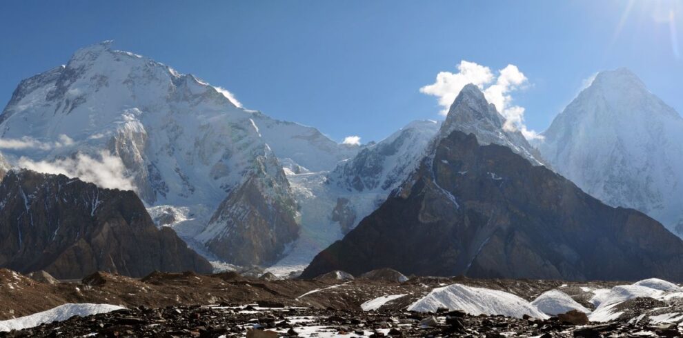
K2, standing at a towering height of 28,251 feet (8,611 meters) above sea level, is the second-highest mountain on Earth, surpassed only by Mount Everest. Its remote location, extreme altitude, and notoriously harsh weather conditions make it one of the most challenging peaks for mountaineers worldwide. As we embark on the K2 Expedition of 2024, we are setting our sights on a daring adventure that only the most skilled and determined climbers can undertake.

The Historical Significance

K2’s allure extends beyond its physical grandeur. It has a rich history of exploration and conquest, with the first successful ascent achieved by an Italian team in 1954. Since then, K2 has witnessed numerous attempts, some ending in triumph, while others in tragedy. The allure of K2 lies not just in its height but also in the mystique surrounding its unforgiving slopes.

Preparing for the Ascent: The Team and Training

The Dream Team

Our 2024 K2 Expedition boasts a roster of accomplished climbers, each possessing a wealth of experience in high-altitude mountaineering. The team comprises individuals who have conquered peaks like Everest, Annapurna, and the formidable Himalayan giants. United by a shared passion for adventure, they are more than just a team; they are a family bound by the quest for the ultimate challenge.

The Challenges of K2: What Lies Ahead

Unpredictable Weather

K2’s position near the convergence of several major weather systems makes it a magnet for storms. The Savage Mountain is notorious for sudden, severe weather changes, which can turn an ascent into a life-or-death struggle. Our team understands the importance of monitoring weather patterns meticulously and making wise decisions in the face of impending storms.

Technical Difficulties

The climb up K2 is not just a test of physical endurance but also a battle against technical challenges. Steep rock faces, icefalls, and the infamous Bottleneck – a narrow passage prone to avalanches – are obstacles that must be navigated with precision. Each team member is equipped with the latest in climbing gear and safety equipment to ensure their safety.

The Journey Begins

Base Camp: The Starting Point

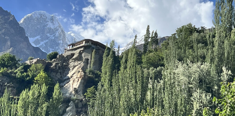
Our journey to K2’s summit begins at Base Camp, a temporary settlement at approximately 16,732 feet (5,100 meters). Here, climbers acclimatize to the high altitude, prepare gear, and discuss strategy. It’s a crucial phase in the expedition, as it sets the tone for the grueling ascent ahead.

The Route

The most common route to K2’s summit is the Abruzzi Spur, a challenging path that involves negotiating steep rock walls and ice-covered slopes. Our team has studied this route meticulously and will follow it with precision, inching closer to the summit step by step.

The Summit Push: Triumph or Tragedy

The Final Ascent

The final push to K2’s summit is a heart-pounding endeavor. Climbers leave Camp 4, the last high camp, in the early hours of the morning to maximize their chances of reaching the summit and descending before the afternoon storms arrive. The climb is physically and mentally demanding, with every step a testament to human determination.

Achieving the Dream

Standing on K2’s summit is a dream that few can realize. It’s a moment of unparalleled accomplishment, an affirmation of the human spirit’s indomitable will. Our team is driven not only by the desire to conquer the Savage Mountain but also to inspire others to pursue their dreams relentlessly.

Conclusion: The K2 Expedition 2024 – A Triumph of Human Spirit

As we embark on this remarkable journey to K2 in 2024, our team carries with them the weight of history, the spirit of adventure, and the determination to overcome the impossible. The Savage Mountain may be unforgiving, but it is also a testament to human resilience and the unyielding pursuit of greatness. We are poised to make our mark on K2’s slopes and etch our names alongside the brave souls who have dared to conquer this majestic peak.

K2 Expedition

Duration: 45 days Altitude: 8,611M
Range: Karakorum Camp nights:  35-38
Hotels nights: 4-6  
Grade: Climbing Savage Mountain Best Period: June-September

Itinerary

All clients will be picked up by World Adventure Tours representative on arrival at Islamabad International Airport and taken to the group hotel. Land Only package services begin with this transfer to the group hotel. The majority of international flights arrive in the early morning and you may want to rest before lunch.
Depending time availability, there may be an option to do some sightseeing in Islamabad, a city purpose-built in 1961 as the new capital of Pakistan. Alternatively, we could visit the Twin City of Rawalpindi a town from the days of the British Raj. The two cities are very different in character; the older settlement is rather sprawling with enormous and complicated bazaars where you can easily get fascinatingly lost. Islamabad, by contrast, is much more open, a modern city with many parks and wide streets arranged on a grid system. There is not always the opportunity to include a sightseeing tour and, if there is, it is optional and there will be a charge payable locally.
Accommodation: Hotel
Meals: Breakfast

Given good weather, we will fly to Skardu (perhaps the most spectacular commercial flight in the world, with magnificent views of Nanga Parbat the 9th highest mountain in the world. If the weather doesn’t allow the flight we take the Karakorum Highway on the old silk route. This is just spectacular. It’s a long drive but one of the great journeys of the world between the deep gorges of the mighty Indus. Driving over Babsur Pass will minimize the distance and the night stay will be in Chilas. (10-12 hour drive). Upon arrival at Skardu hotel, we shall have a gear check-up session after some rest and the evening can be spent visiting Bazars, historical forts, scenic lakes, or visiting ancient rock inscriptions, one of which is of 8th-century Manthal Buddha Rock that shows traces of Buddhist monks and pilgrims who had influence in the area before Islam.
Accommodation: Hotel
Meals: Breakfast, Lunch & Dinner

We leave Skardu by jeep for Ascoli, passing through the fertile Shigar Valley. The last 2 hours of the drive cover the ground which used to make up the first 2 days’ walk of the trek and includes the passage of the infamous Braldu Gorge section. This high and steep-sided valley is prone to landslides and we may have to walk short sections of the road where it has been made unstable by rock-fall. Given reasonable road conditions, we will spend our first night under canvas in this famous Balti village high above the thundering Braldu River. Askole is a single street of wooden houses, backed by irrigated fields of corn and potatoes and groves of apricot trees.
Accommodation: Camping
Meals: Breakfast, Lunch & Dinner

Day 4 :

First day of walk towards Jhola Campsite (3,100 m) via Biafo Glacier
We set off early to avoid the heat of the day. The route is gentle and enjoyable. We cross the Biafo Glacier on the way and get our first sight of the Paiyu pinnacles. We will be trekking for around 5 hours to the Jula camp today. Our lunch point Korofong (3,075 m) lays across the glacier’s other foot. The trees here are habitats for a variety of beautiful birds.
From Korofong we gain altitude and follow the Braldu course till we reach Panma River which is crossed by taking a detour through a trail built on the face of the cliff. These pulley bridges known as Jhola were common in the Karakorum Mountains. Beyond this bridge is our campsite called Jhola.
Accommodation: Camping
Meals: Breakfast, Lunch & Dinner
Ascent: 290
Descent: 190
Distance: 21KM
Time: 6-7 hours trekking

Day 5 :

Trek to Paiju (3,380 m) through Braldu Valley
Trek to Paiju (3,380m) 4 to 5 hours walking. The path is quite loose in places and again it is likely we will have to take boots off where the river has flooded the path in a few places. Paiju is a green oasis under the shadows of Paiju Peak (6,611m). From this camp, we have the first views of the immense Baltoro Glacier.
Accommodation: Camping
Meals: Breakfast, Lunch & Dinner
Ascent: 570
Descent: 290
Distance: 22KM
Time: 7-8 hours trekking

Today is a rest day at paiju to aid acclimatization and an important resting point for porters, they prepare food for the trek ahead. Normally there is much singing, drumming (or barrel bashing), and dancing amongst the porters with a real feel-good atmosphere.
Accommodation: Camping
Meals: Breakfast, Lunch & Dinner

Another early walk of approximately one hour brings us to the snout of the Baltoro. After viewing the outpouring of meltwater from the ice we climb up onto the back of this great beast. At this point, the ice of the glacier is completely covered by rubble and rocks, and going here can be quite tough. Finally reaching Khoborsay camping place (3800m). we would be able to see the cathedral Towers, the Trango, and the striking rock tower of Uli Biafo.A great day of trekking over difficult and mixed terrain.
Accommodation: Camping
Meals: Breakfast, Lunch & Dinner
Ascent: 610
Descent: 220
Distance: 13KM
Time: 7-8 hours trekking

Today is a short day. we continue Baltoro glacier on the lateral moraines or sometimes the glacier itself, passing great Trango and the isolated pillar of the Nameless Tower to our next camp Rdukas (3900m). This is a truly awesome place a hundred meters above the glacier we should reach here in time for a late lunch and the rest of the afternoon is free to tend to camp chores or just to soak up our fabulous situation.
Accommodation: Camping
Meals: Breakfast, Lunch & Dinner
Ascent: 250
Descent: 140
Distance: 7KM
Time: 3-4 hours trekking

On this day we follow the moraine edge and climb up onto the glacier. Soon we come to have the enchanting view of Mashabrum (7821m) on our right side. Ascending and descending on the mountains of rubbles over the ice we have a glimpse ahead to the peaks which surround Concordia. Goro is the camp name (4290m) and camping one of the largest glaciers outside the polar region with an attractive view of Gasherbrum IV (7925m).
Accommodation: Camping
Meals: Breakfast, Lunch & Dinner
Ascent: 330
Descent: 90
Distance: 12KM
Time: 6-7 hours trekking

Today, we move up to Concordia passing on Baltoro, views of Broad Peak (8051 m) appear while Marble and Crystal Peaks appear on the left. K2 remains concealed till the minute we reach Concordia; a breathtaking sight that becomes a beautiful memory forever. Concordia is a wide area of glaciers which is one of the greatest places on earth. We will be surrounded by 4 eight-thousanders, 10 out of 30 highest peaks in the world. The camp will be set at 4,500 m in Concordia on the moraine.
Accommodation: Camping
Meals: Breakfast, Lunch & Dinner
Ascent: 250
Descent: 40
Distance: 12KM
Time: 5-6 hours trekking

Go to broad peak base camp (4800m), K-2 base camp (5100m) 0r Rest at Concordia.
If you chose to go, start early in the morning you can return to Concordia in the evening. On this day, we can start early through crevasses and small rivers created by melting ice. We follow on to the glacier that is named after Godwin Austin who first declared K2’s height. After three hours we will be at Broad Peak base camp where we will have a great sight of the astonishing Karakoram 2nd (K2), Mitre Peak behind us, and Broad Peak. We walk on the moraine which is mostly boulders. However, we do walk on ice occasionally. After another 3 hours trek, we shall complete a one-way journey of the K2 Base Camp reaching a moraine safe zone, a traditional base camp area for K2 climbers.
One can also visit Gilkey Memorial if time allows. The memorial has names of brave souls inscribed on plates and plagues. These tough ones died attempting K2. The decisions about trekking to K2 Base Camp, Broad Peak BC, Gilkey Memorial, choosing one or another or all options, or choosing to rest at Concordia on this day depends on the participants. Return to Concordia on this day is compulsory.
Accommodation: Camping
Meals: Breakfast, Lunch & Dinner
Ascent: 300-600
Descent: 300-600
Distance: 6-8KM
Time: 6-12 hours trekking

Day 38: Trek down to Concordia
Day 39: Trek to Trek to Rdukas
Day 40: Trek to Trek to Paiju
Day 41: Trek to Trek to Jhula
Day 42: Trek to Ascoli and drive to Rdukas
Day 43: Fly to Islamabad
Day 44: Contingency day for possible flight delays.
Skardu is a ‘weather dependent’ airport which means the planes will only fly here if the visibility allows line of sight to the runway by the pilot on the approach. Fortunately, the weather is mostly clear in the Karakorum but local weather conditions can bring clouds and rain from time to time. If we cannot fly we will travel down to Islamabad by road along the spectacular Karakorum Highway. If we flew up to Islamabad this will be an added bonus as it is a fantastic travel experience in its own right. The drive down the Indus River to Islamabad takes two days so this is an important contingency day to allow for this. If we have flown to Islamabad this will be a further day for sightseeing in the capital and your leader will advise the group on the options available for today.
Accommodation: Hotel
Meals: Breakfast

Day 45
Departure from Islamabad. Airport transfer from the hotel.
Our land package for K-2 Trek ends only with breakfast and transfer to the airport.
Accommodation: Hotel
Meals: Breakfast

Cost

What is Included

Not Included

You can send your enquiry via the form below.

K2 Climbing

Expedition Highlights

  • 2-16
  • 8,611M
  • All Meals
  • Plan, Bus/Coach/Jeep